To become a DGPS surveyor, you typically need to have a degree or diploma in surveying, geomatics engineering, or a related field. Some employers may also require additional training or certification in DGPS technology and software.
There are various institutions and organizations that offer DGPS surveyor training programs. These programs typically cover topics such as geodetic concepts, satellite surveying, DGPS data collection, processing and analysis, and surveying software applications.
Some popular training programs include the DGPS Surveying Certificate Program offered by the International Association of Continuing Education and Training (IACET), the DGPS and GNSS Training Program offered by Trimble Navigation Ltd, and the DGPS Surveying Course offered by the Surveying and Spatial Sciences Institute (SSSI) in Australia.
It is important to note that DGPS surveying requires a high level of technical expertise and attention to detail, as even minor errors in data collection or analysis can result in significant errors in the final results. As such, it is important to receive comprehensive training and stay up-to-date with the latest technology and best practices in the field.
Here are some more details about DGPS surveyor training:
Educational Requirements: DGPS surveyors typically have a degree or diploma in surveying, geomatics engineering, or a related field. Some employers may also require a professional certification such as the Certified Survey Technician (CST) designation offered by the National Society of Professional Surveyors (NSPS).
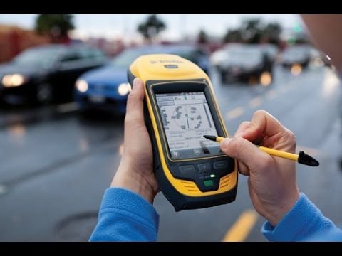
DGPS Technology and Software: DGPS surveyor training typically includes hands-on experience with the latest DGPS technology and software applications. This includes GPS receivers, antenna systems, data collectors, and processing software such as Trimble Business Center, Leica Geo Office, or Carlson SurvCE.
Surveying Techniques: DGPS surveyor training covers a range of surveying techniques such as geodetic concepts, coordinate systems, satellite surveying, and data processing techniques. Training also includes methods for conducting field surveys and mapping, including setting up control points, traversing, leveling, and using total stations and other surveying instruments.
Safety: Safety is an important aspect of DGPS surveying, and training covers safety procedures for working in the field, including working around heavy equipment, navigating challenging terrain, and working in adverse weather conditions.
Continuing Education: DGPS surveyor training is ongoing, and professionals in this field are required to keep up-to-date with the latest technology and best practices. This may involve attending professional development courses, workshops, conferences, or online webinars.
Certifications: There are various certifications available for DGPS surveyors, including the Certified Survey Technician (CST) designation offered by the National Society of Professional Surveyors (NSPS) and the Professional Land Surveyor (PLS) designation offered by state licensing boards.