UAV Drone Survey Solutions for Fast and Accurate Site Surveys
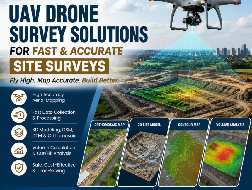
UAV Drone Survey Solutions for Fast and Accurate Site Surveys In today’s fast-paced construction, infrastructure, mining, and land development industries, speed and precision are essential for successful project execution. UAV Drone Survey Solutions for Fast and Accurate Site Surveys have become a revolutionary approach to collecting high-quality geospatial data within a fraction of the time