GPR Survey
A GPR survey involves using a specialized antenna to focus electromagnetic pulses (radar signals) of short duration into the ground. These signals propagate and
Read MoreLCT has well qualified civil engineers who have esteemed experience in handling civil related works. We have associates qualified from Institution of Valuers. Our civil engineering division also has engineers qualified as Chartered Engineer from the Institution of Engineers and Engineering Council of India. We provide the following services in utmost confidence.
Civil engineering surveying is a branch of civil engineering that deals with the measurement and mapping of land and its features. It involves the use of various techniques and equipment to determine the location, size, shape, and contour of land features, such as buildings, roads, bridges, and natural landscapes. The data collected from surveying is used to design and construct various civil engineering projects, including transportation systems, water supply systems, and land development projects. Surveying plays a critical role in ensuring that civil engineering projects are planned and executed accurately, efficiently, and safely.

Global Positioning System (GPS) Surveying: GPS is a satellite-based navigation system that uses a network of satellites to determine the location of a receiver on the ground. GPS surveying is used to determine the coordinates of various points on the earth’s surface accurately.
Total Station Surveying: Total station surveying involves the use of an electronic device that combines a theodolite and a distance meter to measure angles and distances. Total station surveying is used to determine the location and elevation of various land features accurately.
Leveling: Leveling involves measuring the difference in elevation between two points using a level instrument. It is used to determine the height of structures and to establish the contour lines of land.
Photogrammetry: Photogrammetry involves using aerial photographs to create 3D models of land features. It is used to map large areas quickly and accurately.
Remote Sensing: Remote sensing involves the use of satellite images and other remote sensing technologies to obtain information about land features.
Civil engineering surveying is an essential component of the design and construction of civil engineering projects. It provides the necessary information to engineers and construction professionals to ensure that projects are designed accurately and constructed safely. Surveying also plays a critical role in ensuring that projects are completed on time and within budget.
Land Surveying: Land surveying is the most common type of civil engineering surveying. It involves measuring and mapping the features of the land, including boundaries, contours, and topography. Land surveying is used to establish property boundaries, design land subdivisions, and create maps for construction projects.
Construction Surveying: Construction surveying involves measuring and marking out the location of structures and infrastructure during the construction process. This includes setting out the location of buildings, roads, bridges, and other structures on the ground.
Geodetic Surveying: Geodetic surveying involves the use of advanced mathematical and physical principles to determine the size and shape of the earth’s surface. It is used to establish accurate global positioning and to measure large-scale changes in the earth’s surface.
Hydrographic Surveying: Hydrographic surveying involves measuring and mapping the underwater features of rivers, lakes, and oceans. It is used to design and construct water-related infrastructure, such as dams, ports, and coastal defenses.
Mining Surveying: Mining surveying involves measuring and mapping the underground features of mines and tunnels. It is used to design and construct mining infrastructure, such as shafts and tunnels, and to ensure the safety of mine workers.
Civil engineering surveying is an interdisciplinary field that requires a combination of technical, mathematical, and practical skills. Surveyors must be familiar with various equipment and techniques and have a solid understanding of mathematics, geometry, and trigonometry. They must also be able to interpret and analyze data accurately and effectively communicate their findings to engineers, architects, and other stakeholders.


Land Coordinated Technology Company in India, provides the best quality of services in Civil Engineering Surveying, GPR Survey, Land Surveying, and Civil Based Traffic Services etc.

A GPR survey involves using a specialized antenna to focus electromagnetic pulses (radar signals) of short duration into the ground. These signals propagate and
Read More
GIS deals with the information about the earth and its features. The spatial and non-spatial data of the Earth’s surface are managed precisely with the
Read More
LCT has well qualified civil engineers who have esteemed experience in handling civil related works. We have associates qualified from Institution of Valuers.
Read More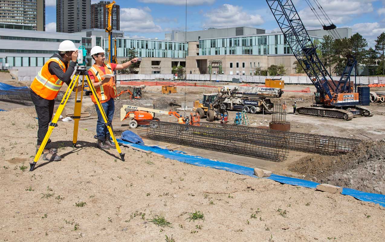
LCT has well qualified civil engineers who have esteemed experience in handling civil related works. We have associates qualified from Institution of Valuers.
Read More
LCT has well qualified civil engineers who have esteemed experience in handling civil related works. We have associates qualified from Institution of Valuers.
Read More
LCT has well qualified civil engineers who have esteemed experience in handling civil related works. We have associates qualified from Institution of Valuers.
Read More


LCT provides Training on the Civil and Geomatics platform with its expert trainers. We provide Government of India approved and recognised course.
Get a professional BSS Diploma in Civil Draughts man with our widely recognized certificate programme.
Students get theoretical and practical knowledge from our Industrial experts. Our students are made to develop the skills to face the real world projects confidently.
Drone surveying is a rapidly growing field that uses unmanned aerial vehicles (UAVs), or drones, to collect high-resolution data for a variety of applications such as mapping, construction, land surveying, and environmental monitoring.
View Course DetailsChoose wisely and move ahead in your career by taking the GIS Professional Certificate course from LCT. This is a best course which covers all the advanced technologies in the syllabus. The course will be taught by industrial experts, so the students get abundant knowledge on the technology and the real world projects.
View Course DetailsCAD (Computer-Aided Design) Draftsman training course is designed to train individuals in the use of computer software and technology to create technical drawings and 3D models used in the manufacturing, engineering, and architecture industries.
View Course Details


