


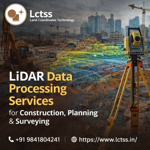
In today’s fast-paced construction and infrastructure landscape, accuracy, speed, and data reliability are critical for project success. LiDAR Data Processing Services play a vital role in delivering highly precise terrain models, elevation data, and spatial insights required for construction, urban planning, and land surveying projects.
LCTSS (Land Coordinates Technology) offers advanced LiDAR data processing services that transform raw LiDAR point cloud data into meaningful, decision-ready outputs. With expert professionals, cutting-edge software, and industry-proven workflows, LCTSS ensures high-accuracy geospatial deliverables that meet global engineering and surveying standards.
Table of Contents
ToggleLiDAR (Light Detection and Ranging) is a remote sensing technology that uses laser pulses to measure distances between the sensor and the Earth’s surface. The captured raw data, known as point cloud data, contains millions of elevation points.
LiDAR data processing is the critical step where raw point cloud data is cleaned, classified, filtered, and converted into usable products such as:
Digital Terrain Models (DTM)
Digital Surface Models (DSM)
Contours and elevation maps
3D models
GIS and CAD-ready datasets
Without proper data processing, LiDAR data cannot be effectively used for construction or surveying applications.
LiDAR data processing helps construction professionals:
Analyze existing site conditions
Perform cut-and-fill volume calculations
Plan foundations and earthworks
Reduce costly rework and errors
Improve project timelines and accuracy
Urban planners rely on processed LiDAR data for:
Smart city planning
Road and highway alignment
Drainage and flood modeling
Utility corridor planning
Environmental impact analysis
Surveyors benefit from LiDAR processing through:
High-precision topographic mapping
Boundary and alignment surveys
Large-area coverage with minimal field time
Accurate elevation and contour generation
LCTSS (Land Coordinates Technology) is a trusted name in geospatial and surveying solutions, delivering high-quality LiDAR data processing services across India.
✔ Highly experienced LiDAR processing professionals
✔ Advanced software & automated workflows
✔ High-accuracy classification and validation
✔ Cost-effective and scalable solutions
✔ Fast turnaround time
✔ Compliance with international standards
LCTSS supports projects of all sizes—from small construction sites to large-scale infrastructure developments.
We remove noise, errors, and redundant data to deliver clean, high-quality point clouds ready for analysis.
Accurate classification of:
Ground
Vegetation
Buildings
Roads
Utilities
Water bodies
Highly accurate bare-earth models ideal for:
Earthwork calculations
Drainage design
Road and rail planning
DSM includes surface features such as buildings and trees, useful for:
Urban planning
Line-of-sight analysis
Telecom and infrastructure planning
Generation of precise contours and elevation maps in required intervals for construction and land development.
Accurate volume estimation for:
Excavation planning
Land grading
Mining and quarry projects
Creation of detailed 3D terrain and surface models for better project visualization and stakeholder presentations.
Processed LiDAR outputs compatible with:
AutoCAD
Civil 3D
ArcGIS
QGIS
Other engineering platforms
LCTSS LiDAR processing services are widely used in:
Construction & infrastructure projects
Road, highway & railway projects
Urban development & smart cities
Flood risk & drainage analysis
Mining & quarrying
Power line & utility mapping
Environmental & forestry studies
Large-scale land surveys
Data Acquisition Review
Analyze raw LiDAR datasets from aerial, UAV, or mobile platforms.
Data Cleaning & Noise Removal
Remove outliers and incorrect returns.
Point Classification
Categorize data into accurate feature classes.
Model Generation
Create DTM, DSM, contours, and 3D models.
Quality Check & Validation
Ensure accuracy and compliance with project specifications.
Final Delivery
Provide outputs in client-required formats.
Civil & construction companies
Surveying firms
Engineering consultants
Government & municipal authorities
Real estate developers
Infrastructure planners
Compared to traditional surveying methods, LiDAR data processing offers:
Faster data collection
Higher accuracy
Cost efficiency for large areas
Minimal fieldwork
Rich 3D datasets for advanced analysis
With increasing demand for precision and speed, LiDAR-based solutions are becoming the industry standard.
⭐ Client Testimonial 1
“LCTSS delivered highly accurate LiDAR data processing for our highway project. Their outputs helped us reduce rework and saved significant time.”
— Project Manager, Infrastructure Company
⭐ Client Testimonial 2
“We were impressed by the quality of DTM and contour data provided by LCTSS. Their team is professional and responsive.”
— Senior Surveyor
⭐ Client Testimonial 3
“LCTSS LiDAR processing services helped us complete our land development project efficiently. Excellent accuracy and fast delivery.”
— Construction Consultant
⭐ Client Testimonial 4
“The LiDAR point cloud classification was precise and met international standards. Highly recommended.”
— GIS Analyst
LiDAR data processing is used for construction planning, land surveying, urban development, volume calculations, and infrastructure design.
When processed correctly, LiDAR data can achieve centimeter-level accuracy, making it ideal for engineering and surveying projects.
Yes, LCTSS has the expertise and infrastructure to process large-scale LiDAR datasets efficiently.
We provide outputs in CAD, GIS, and industry-standard formats based on client requirements.
Yes, LiDAR processing is scalable and can be applied to both small and large projects.
Project timelines depend on data size and complexity, but LCTSS ensures fast turnaround without compromising accuracy.
Yes, LCTSS provides LiDAR data processing services across India.
Absolutely. LiDAR is highly effective for cut-and-fill and excavation volume estimation.
Construction, surveying, urban planning, mining, utilities, and environmental sectors benefit greatly.
LCTSS combines technical expertise, advanced tools, and industry experience to deliver reliable and cost-effective LiDAR solutions.
LiDAR Data Processing Services for Construction, Planning & Surveying are transforming the way projects are planned and executed. With accurate terrain models, detailed elevation data, and fast turnaround times, LiDAR technology offers unmatched advantages.
LCTSS (Land Coordinates Technology) stands as a trusted partner, delivering professional, accurate, and reliable LiDAR data processing services tailored to modern engineering and surveying needs.
📞 Contact LCTSS today to leverage advanced LiDAR solutions for your next project.