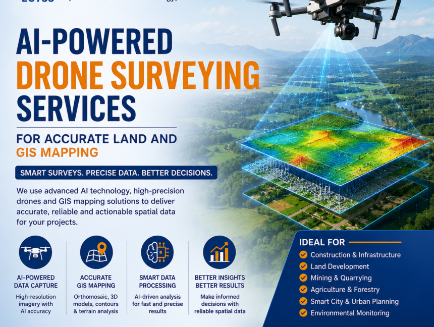
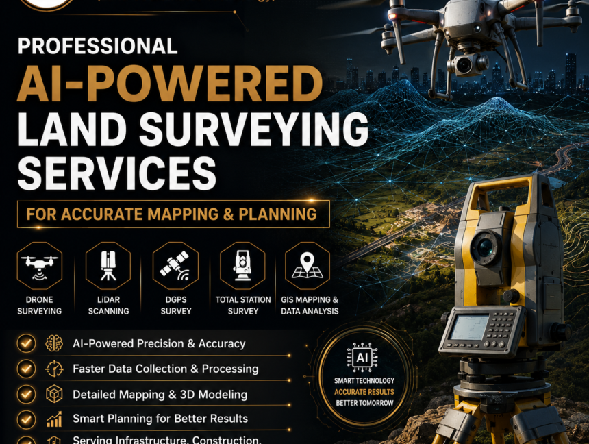
Tag: Land Surveying services

  • Blog
  • Tag: Land Surveying services
Future of GIS Mapping with AI, GPS & Drone Surveying Technology
  • No Comments

Future of GIS Mapping with AI, GPS & Drone Surveying Technology

Future of GIS Mapping with AI, GPS & Drone Surveying Technology The future of GIS Mapping with AI, GPS & Drone Surveying Technology is transforming the way industries collect, analyze, and manage spatial data. Businesses today require accurate mapping solutions for land development, infrastructure planning, agriculture, mining, construction, and smart city projects. Traditional surveying methods,

  • No Comments

Civil Surveying Services with Advanced GPS, Total Station & Drone Technology

Civil Surveying Services with Advanced GPS, Total Station & Drone Technology In today’s fast-evolving construction and infrastructure landscape, precision and efficiency are more critical than ever. Civil surveying plays a vital role in ensuring that projects are planned, designed, and executed with complete accuracy. At Lctss (Land Coordinates Technology), we deliver cutting-edge  civil surveying services

  • No Comments

Expert Civil Engineering Land Surveying Services Near You

Expert Civil Engineering Land Surveying Services Near You When it comes to successful infrastructure and construction projects, accuracy is everything. At Land Coordinates Technology (LCTSS), we provide expert civil engineering land surveying services near you with a strong focus on precision, reliability, and timely delivery. Whether it is a residential building, commercial complex, highway project,

  • No Comments

Land Surveyors for Boundary, DGPS & Total Station Surveys – LCTSS (Land Coordinates Technology)

Accurate land surveying is the foundation of every successful construction, infrastructure, and land development project. At LCTSS (Land Coordinates Technology), we provide professional Land Surveyors for Boundary, DGPS & Total Station Surveys, delivering precise, reliable, and legally compliant survey solutions across Tamil Nadu, Kerala, Karnataka, and other regions in India. With advanced technology, experienced surveyors,