


Table of Contents
ToggleIn the modern construction and infrastructure industry, advanced technologies are transforming the way civil engineering projects are planned, designed, and executed. One of the most powerful technologies currently used in the surveying and mapping field is LiDAR (Light Detection and Ranging). This technology captures highly accurate 3D data of the earth’s surface and surrounding structures using laser pulses. However, the raw LiDAR data collected through drones, aerial platforms, or ground-based scanners requires detailed processing and analysis to convert it into meaningful engineering information. This is where professional LiDAR Data Processing Services play a vital role.
Lctss (Land Coordinates Technology) is one of the trusted providers of LiDAR data processing solutions, offering precise, reliable, and industry-standard services for civil engineering projects. By transforming massive LiDAR datasets into useful outputs such as Digital Elevation Models (DEM), Digital Terrain Models (DTM), contour maps, and 3D models, Lctss (Land Coordinates Technology) helps engineers, planners, and construction professionals make better decisions during every stage of a project.
LiDAR technology has become an essential tool in civil engineering because it significantly reduces the time and effort required for traditional surveying methods. With accurate terrain mapping and high-resolution spatial data, engineers can understand the landscape in detail, allowing them to plan projects more efficiently. The processed data can be used for road construction, bridge development, railway alignment, drainage design, flood modeling, urban infrastructure planning, and many other civil engineering applications.
One of the best uses of LiDAR data processing services in civil engineering is high-precision terrain mapping and land surveying. Traditional land surveying methods often require extensive fieldwork and can take a considerable amount of time, especially when working in large or difficult terrains. LiDAR technology simplifies this process by capturing millions of data points quickly, allowing surveyors to generate detailed and accurate maps of the land surface.
Through advanced processing techniques, LiDAR data can be converted into Digital Terrain Models (DTM) and Digital Surface Models (DSM), which are extremely useful for civil engineering design and planning. These models help engineers understand the slope, elevation changes, and natural features of the land before starting construction. With this information, civil engineers can plan the layout of roads, drainage systems, buildings, and other infrastructure with improved accuracy.
Lctss (Land Coordinates Technology) specializes in converting raw LiDAR datasets into highly accurate terrain models and contour maps. These processed outputs help civil engineers analyze topographical variations and plan projects efficiently. For example, when constructing highways or railways across uneven terrain, LiDAR-derived terrain models allow engineers to determine the best alignment, reducing construction costs and minimizing environmental impact.
In addition, LiDAR data processing also helps identify natural obstacles such as vegetation, rocks, or existing structures that may affect construction planning. By filtering and classifying LiDAR point clouds, experts at Lctss (Land Coordinates Technology) can separate ground points from non-ground features, enabling engineers to focus only on the terrain data needed for precise project design.
Another important use of LiDAR data processing services is in infrastructure planning and urban development. As cities continue to grow and infrastructure demands increase, accurate spatial data becomes crucial for designing roads, bridges, drainage networks, and utility systems. LiDAR technology provides highly detailed 3D data that allows engineers and planners to visualize urban environments and design infrastructure more effectively.
With LiDAR-based models, civil engineers can study existing structures, road networks, and land elevation patterns before starting new construction projects. This helps in identifying potential design challenges and planning infrastructure that integrates smoothly with existing developments. Urban planners also rely on LiDAR data to analyze building heights, street layouts, and surrounding landscapes to ensure proper urban planning.

Lctss (Land Coordinates Technology) processes LiDAR datasets to generate 3D city models, building outlines, road networks, and detailed surface models. These outputs help civil engineers and urban planners simulate construction projects and analyze different design possibilities before actual construction begins. By using LiDAR data processing, project stakeholders can make informed decisions that reduce design errors and construction delays.
For large-scale infrastructure projects such as metro rail systems, highways, and smart city developments, LiDAR data processing plays a significant role in providing accurate site information. The detailed datasets generated by Lctss (Land Coordinates Technology) allow engineers to conduct advanced analysis, such as slope stability evaluation, road alignment optimization, and drainage planning. This leads to more efficient infrastructure development and improved long-term sustainability.
Flood management and environmental analysis are also major areas where LiDAR data processing services provide significant benefits in civil engineering. Accurate elevation data is essential for understanding how water flows across landscapes, especially in flood-prone regions. LiDAR technology captures highly detailed elevation information that can be used to model flood scenarios and identify areas at risk.
By processing LiDAR data, engineers can create high-resolution Digital Elevation Models (DEM) that help simulate water flow, drainage patterns, and flood zones. These models allow civil engineers and environmental planners to design effective flood protection systems, including drainage channels, embankments, and retention basins.
Lctss (Land Coordinates Technology) provides advanced LiDAR data processing services that support flood modeling and hydrological analysis. The processed datasets help government agencies, engineering consultants, and infrastructure developers plan flood mitigation strategies and improve disaster preparedness. With accurate terrain information, engineers can identify low-lying areas and design proper drainage infrastructure to prevent water accumulation and flooding.
In addition to flood risk assessment, LiDAR data processing also helps in environmental monitoring and land management. Civil engineering projects often require environmental impact assessments before construction begins. LiDAR-derived terrain models and vegetation analysis can provide valuable insights into land cover, forest density, and ecological features, helping engineers minimize environmental damage during project execution.
By using LiDAR data processing services from Lctss (Land Coordinates Technology), civil engineering teams can achieve a balance between infrastructure development and environmental sustainability. The detailed spatial information obtained through LiDAR allows engineers to plan projects responsibly while protecting natural ecosystems.
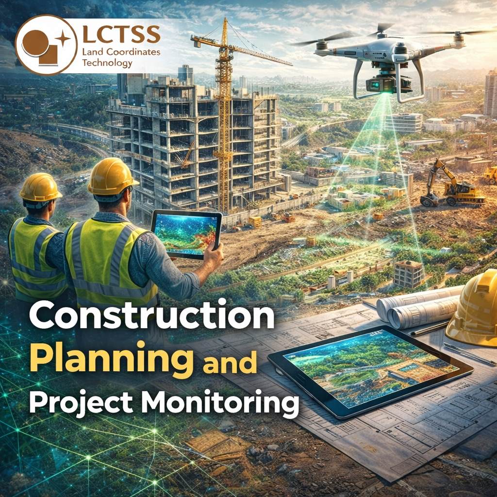
LiDAR data processing services are also widely used in construction planning and project monitoring. Before construction begins, engineers need accurate measurements and terrain analysis to design foundations, structures, and transportation networks. LiDAR provides a comprehensive view of the project site, enabling engineers to plan construction activities with greater precision.
During the planning stage, LiDAR-derived data helps engineers calculate earthwork volumes, determine excavation requirements, and design stable foundations. The detailed point cloud data can be used to create 3D models of construction sites, allowing engineers to visualize the entire project before actual construction begins.
Lctss (Land Coordinates Technology) offers specialized LiDAR data processing services that convert raw point cloud data into actionable engineering outputs such as contour maps, volumetric calculations, and 3D terrain models. These outputs enable construction companies to optimize resource allocation, reduce material wastage, and improve project efficiency.
LiDAR technology is also extremely useful for monitoring construction progress. By conducting periodic LiDAR scans of the construction site, engineers can compare current site conditions with original project designs. This helps identify deviations, track project progress, and ensure that construction activities follow the planned design specifications.
Furthermore, LiDAR data processing can support structural inspections and maintenance planning. For large infrastructure projects such as bridges, dams, and highways, LiDAR-based 3D models provide accurate measurements that help engineers detect structural issues and plan maintenance activities more effectively.
LiDAR technology has revolutionized the way civil engineering projects are planned and executed. From terrain mapping and land surveying to infrastructure development, flood modeling, and construction monitoring, the applications of LiDAR data processing services are vast and highly valuable. By converting complex LiDAR datasets into accurate and usable engineering outputs, professionals can gain deeper insights into project sites and make more informed decisions.
Lctss (Land Coordinates Technology) is committed to delivering high-quality LiDAR data processing services that meet the evolving needs of the civil engineering industry. With expertise in advanced data processing techniques and modern surveying technologies, Lctss (Land Coordinates Technology) helps engineers, planners, and developers achieve greater accuracy, efficiency, and reliability in their projects.
As civil engineering continues to evolve with new technologies and digital tools, LiDAR data processing will remain a key component in modern infrastructure development. By leveraging the power of LiDAR technology and professional processing services, organizations can ensure better project planning, improved construction quality, and sustainable infrastructure solutions for the future.