


Table of Contents
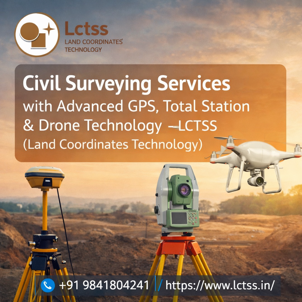
ToggleIn today’s fast-evolving construction and infrastructure landscape, precision and efficiency are more critical than ever. Civil surveying plays a vital role in ensuring that projects are planned, designed, and executed with complete accuracy. At Lctss (Land Coordinates Technology), we deliver cutting-edge civil surveying services powered by advanced GPS systems, Total Station instruments, and drone technology. These modern tools enable us to provide highly reliable data, reduce project risks, and improve overall productivity for a wide range of engineering and construction projects.
Civil surveying forms the foundation of any successful construction project. Whether it is a residential development, commercial building, highway, or large-scale infrastructure project, accurate land data is essential. Our team at Lctss combines technical expertise with innovative surveying technologies to capture precise measurements, analyze terrain conditions, and deliver actionable insights. By integrating advanced tools into our workflow, we ensure that every project starts with a strong and accurate base, helping clients avoid costly errors and delays.
In today’s fast-evolving construction and infrastructure landscape, precision and efficiency are more critical than ever. Civil surveying plays a vital role in ensuring that projects are planned, designed, and executed with complete accuracy. At Lctss (Land Coordinates Technology), we deliver cutting-edge civil surveying services powered by advanced GPS systems, Total Station instruments, and drone technology. These modern tools enable us to provide highly reliable data, reduce project risks, and improve overall productivity for a wide range of engineering and construction projects.
Civil surveying forms the foundation of any successful construction project. Whether it is a residential development, commercial building, highway, or large-scale infrastructure project, accurate land data is essential.
Our team at Lctss combines technical expertise with innovative surveying technologies to capture precise measurements, analyze terrain conditions, and deliver actionable insights. By integrating advanced tools into our workflow, we ensure that every project starts with a strong and accurate base, helping clients avoid costly errors and delays.
Total Station instruments are essential tools in civil surveying, offering unmatched precision in measuring angles, distances, and elevations. At Lctss, we use advanced Total Station equipment to perform detailed site surveys, layout work, and construction staking with exceptional accuracy.
Total Station surveying is widely used in construction projects where precise alignment and positioning are critical. From setting out building foundations to marking structural elements, our surveyors ensure that every measurement is accurate and consistent with the project design. This level of precision helps prevent construction errors, reduces rework, and ensures that projects are completed on time and within budget.
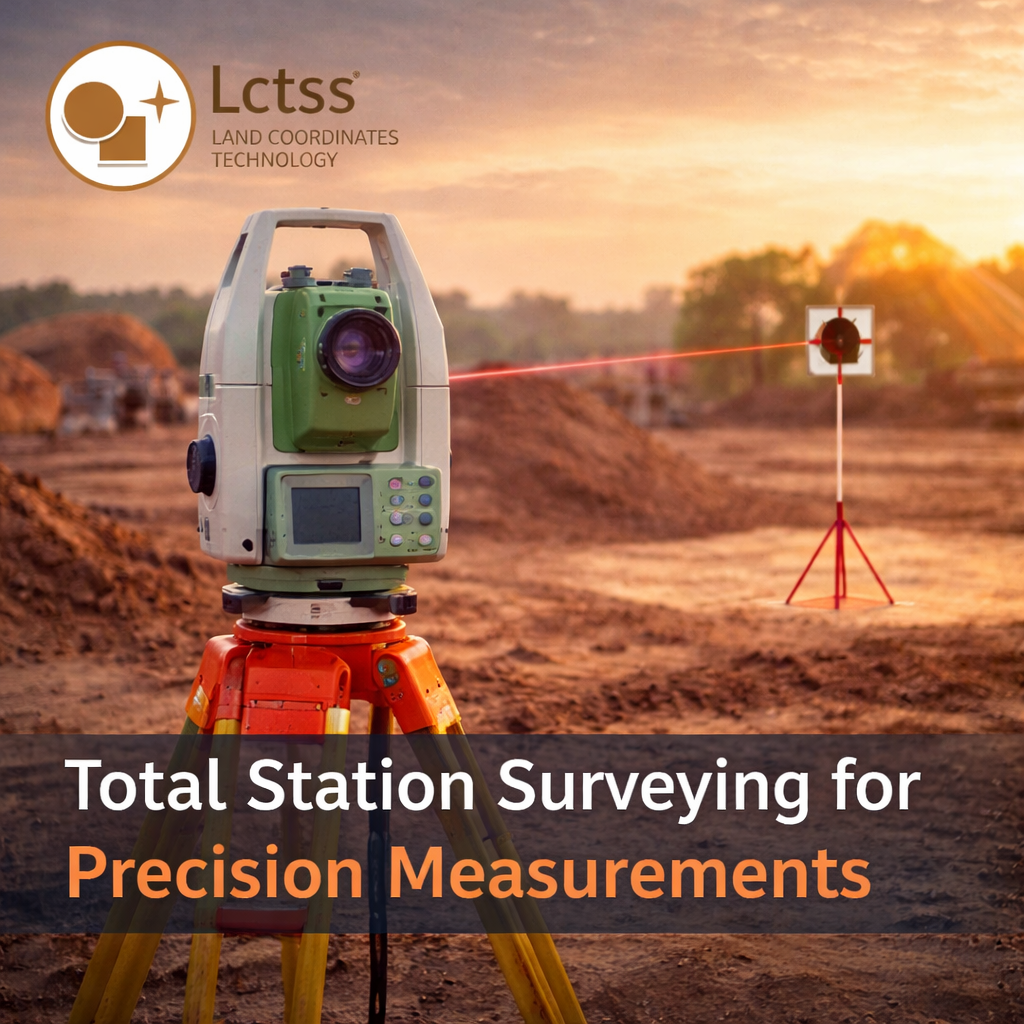
In addition to construction layout, Total Station surveys are also used for topographic mapping, boundary determination, and deformation monitoring. By capturing highly detailed data, we provide clients with a clear understanding of site conditions, enabling better decision-making throughout the project lifecycle. Our expertise in using Total Station technology ensures that every survey meets the highest standards of quality and accuracy.

Drone technology has revolutionized the field of civil surveying by enabling rapid data collection and high-resolution aerial mapping. At Lctss, we leverage advanced drone systems equipped with high-quality cameras and sensors to capture detailed images and generate accurate 3D models of project sites.
Drone surveying offers several advantages over traditional methods. It significantly reduces the time required for data collection, allowing large areas to be surveyed in a fraction of the time. This is particularly beneficial for projects with tight deadlines or extensive land coverage. Additionally, drones can access hard-to-reach or hazardous areas, ensuring safety while still collecting accurate data.
Using drone technology, we provide services such as aerial mapping, photogrammetry, volumetric analysis, and progress monitoring. These capabilities enable clients to visualize their projects in detail, track construction progress, and make informed decisions. The integration of drone data with other surveying technologies ensures a comprehensive and accurate representation of the project site.
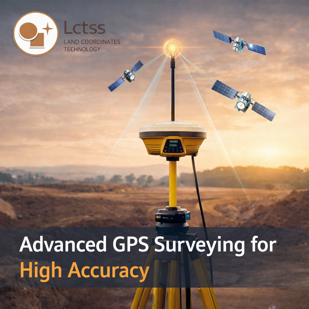
At Lctss, we believe in combining the strengths of multiple technologies to deliver comprehensive surveying solutions. By integrating GPS, Total Station, and drone data, we provide a complete and accurate picture of the project site. This integrated approach ensures consistency across all measurements and enhances the overall quality of the survey.
Our civil surveying services are tailored to meet the specific needs of each project. Whether it is land development, road construction, utility mapping, or industrial infrastructure, we offer customized solutions that align with client requirements. Our team works closely with engineers, architects, and project managers to ensure that all survey data supports efficient planning and execution.
The use of advanced technology also allows us to deliver digital outputs such as 3D models, GIS maps, and detailed reports. These outputs provide valuable insights that help clients optimize design, reduce costs, and improve project outcomes. By staying at the forefront of technological advancements, Lctss ensures that our clients benefit from the latest innovations in civil surveying.
Quality and reliability are at the core of our services at Lctss. We understand that accurate survey data is essential for the success of any construction project, and we are committed to delivering results that meet the highest standards. Our team of experienced surveyors follows strict quality control procedures to ensure that all data is accurate, consistent, and reliable.
We also prioritize efficiency and timely delivery, recognizing the importance of meeting project deadlines. By using advanced tools and streamlined processes, we are able to complete surveys quickly without compromising quality. This ensures that our clients can move forward with confidence, knowing that they have accurate and reliable data to support their projects.
Lctss provides civil surveying services for a wide range of projects, including residential developments, commercial buildings, industrial facilities, roads, bridges, and more. Our expertise in advanced surveying technologies allows us to handle projects of all sizes and complexities with ease.
For land development projects, we provide detailed topographic surveys and boundary mapping to support planning and design. In construction projects, our precise layout and staking services ensure accurate execution of designs. For infrastructure projects, we deliver comprehensive surveys that support efficient construction and long-term maintenance.
Our ability to adapt to different project requirements and deliver customized solutions makes us a trusted partner for civil engineering surveying services. We work closely with clients to understand their needs and provide solutions that add value to their projects.
Civil surveying services with advanced GPS, Total Station, and drone technology have become essential for modern construction and infrastructure development. At Lctss (Land Coordinates Technology), we combine expertise, innovation, and advanced tools to deliver accurate, reliable, and efficient surveying solutions.
By leveraging the latest technologies, we ensure that every project is supported by precise data and actionable insights. Our commitment to quality, efficiency, and customer satisfaction makes us a preferred choice for civil surveying services. Whether you are planning a new development or managing a large-scale infrastructure project, Lctss is your trusted partner for advanced surveying solutions that drive success.