


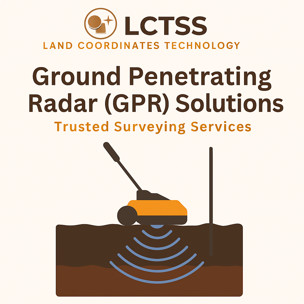
When it comes to land surveying and infrastructure development, understanding what lies beneath the surface is just as important as what is built above it. Excavation without proper subsurface knowledge can lead to damaged utilities, unexpected project delays, and added costs. That’s where Ground Penetrating Radar (GPR) solutions come in.
At Lctss (Land Coordinates Technology), we specialize in delivering trusted GPR survey services for accurate, non-destructive subsurface mapping. Our team combines cutting-edge radar technology with expert analysis to help construction companies, engineers, architects, and land developers detect underground utilities, voids, pipelines, and geological features with unmatched precision.
Table of Contents
ToggleGround Penetrating Radar (GPR) is a non-invasive geophysical method that uses high-frequency electromagnetic waves to scan below the surface. The radar pulses travel through the ground and reflect back when they encounter buried objects, changes in material, or voids. These reflections are then analyzed to create detailed subsurface maps.
Unlike traditional digging or drilling methods, GPR ensures safe and non-destructive surveying, making it one of the most reliable tools for site investigation.
Using GPR survey services offers numerous advantages for construction, civil engineering, and land development projects:
✅ Non-destructive – No need for unnecessary excavation.
✅ Highly accurate – Detects objects and features in real time.
✅ Cost-effective – Prevents utility strikes and costly project delays.
✅ Time-saving – Rapid scanning speeds up project planning.
✅ Safe & reliable – Reduces risk to workers and surrounding infrastructure.
At Lctss, we offer GPR survey services for a wide range of applications:
Identify and map buried utilities like water pipelines, electrical cables, telecom ducts, and gas lines.
Assess soil conditions, detect underground voids, and ensure safety before excavation.
Locate hidden structures, artifacts, and historical remains without disturbing the site.
Detect groundwater tables, bedrock depth, and soil layers for environmental assessments.
Evaluate road thickness, detect voids beneath highways, and inspect pavement conditions.
Scan concrete slabs, locate rebar, and assess structural integrity in existing buildings.
At Lctss (Land Coordinates Technology), we take pride in being one of the leading providers of GPR solutions in India. Our team brings years of expertise in advanced surveying methods and ensures that every project meets international accuracy standards.
What sets us apart:
🔹 Latest GPR equipment with high-frequency radar technology.
🔹 Certified and experienced survey engineers.
🔹 Custom-tailored solutions based on project requirements.
🔹 Comprehensive reporting with clear data visualization.
🔹 Proven track record across Tamil Nadu, Kerala, Karnataka, and beyond.
Site Assessment – Understanding project goals and evaluating terrain.
Data Collection – Using state-of-the-art GPR units to scan subsurface conditions.
Data Processing – Analyzing reflections to identify utilities, voids, or anomalies.
Mapping & Reporting – Delivering detailed maps, CAD drawings, and reports.
Client Consultation – Explaining results and suggesting next steps.
When you choose Lctss GPR solutions, you get:
Reduced risks of accidental utility strikes.
Faster project approvals and safer excavation.
Clear understanding of underground conditions.
Expert guidance from certified survey professionals.
⭐️⭐️⭐️⭐️⭐️ – Ramesh K., Construction Contractor (Chennai)
“Lctss provided us with accurate GPR survey data before our commercial project. Their team saved us from costly utility damages. Highly professional service!”
⭐️⭐️⭐️⭐️⭐️ – Priya S., Infrastructure Planner (Bangalore)
“The reports from Lctss were detailed and easy to interpret. Their GPR survey helped us finalize our design safely. I would definitely recommend their services.”
⭐️⭐️⭐️⭐️⭐️ – Arun M., Land Developer (Kerala)
“We partnered with Lctss for a large land development project. Their GPR solutions were reliable and gave us complete confidence before construction.”
Q1: What is the depth range of GPR surveys?
A: The depth depends on soil type and radar frequency. GPR can typically scan from a few centimeters up to 30 meters.
Q2: Is GPR safe for the environment?
A: Yes, GPR uses non-ionizing electromagnetic waves, which are completely safe for the environment and people.
Q3: How accurate are GPR surveys?
A: GPR provides highly accurate results, with precise detection of buried utilities, voids, and materials when performed by experts like Lctss.
Q4: Can GPR detect plastic pipes?
A: Yes, GPR can detect non-metallic materials such as plastic pipes, although detection depends on soil conditions and pipe size.
Q5: How long does a GPR survey take?
A: The duration varies by project size, but GPR surveys are generally faster than traditional excavation-based methods.
Q6: Do I need a GPR survey before excavation?
A: Yes, it is highly recommended. A GPR survey reduces risks of damaging buried utilities and ensures safer construction.
Q7: Can GPR be used in wet soil conditions?
A: While wet soils can reduce penetration depth, advanced GPR equipment like ours can still provide reliable results.
Q8: What industries benefit from GPR services?
A: Construction, civil engineering, archaeology, environmental studies, land development, and utilities management.
Q9: How does GPR compare with traditional surveys?
A: Unlike drilling or digging, GPR is non-destructive, faster, safer, and more cost-effective.
Q10: Why choose Lctss for GPR services?
A: Lctss combines advanced GPR technology with expert surveying experience, offering accurate reports and trusted solutions across multiple industries.
Ground Penetrating Radar (GPR) solutions are revolutionizing the way land surveys and infrastructure projects are carried out. By providing accurate, safe, and non-destructive subsurface mapping, GPR reduces risks, saves time, and improves project outcomes.
At Lctss (Land Coordinates Technology), we stand as your trusted partner for GPR surveying services in Tamil Nadu, Kerala, Karnataka, and across India. Our commitment to accuracy, safety, and professionalism makes us the first choice for construction companies, land developers, and engineers.
If you’re planning a construction or land survey project, don’t dig blind—survey smarter with Lctss GPR solutions today!