


Table of Contents
ToggleModern surveying has evolved rapidly with the advancement of digital technologies, and one of the most transformative innovations in this field is LiDAR scanning. LiDAR (Light Detection and Ranging) technology has become a powerful tool for capturing highly accurate spatial data and creating precise 3D models of land, structures, and environments. Industries such as civil engineering, construction, infrastructure planning, mining, forestry, and urban development rely heavily on LiDAR for efficient data collection and analysis. As projects become more complex and demand higher levels of accuracy, LiDAR scanning services have become an essential part of modern surveying practices.
At Lctss (Land Coordinates Technology), advanced LiDAR scanning solutions are provided to deliver precise, reliable, and efficient survey data for a wide range of projects. By combining modern equipment, expert professionals, and advanced data processing techniques, Lctss (Land Coordinates Technology) helps clients achieve highly detailed mapping and surveying results that support better planning and decision-making.
Traditional surveying methods often require significant time, manual effort, and fieldwork to collect accurate measurements. Surveyors typically use instruments like total stations, GPS devices, and manual measurement techniques, which may take days or even weeks to complete large-scale surveys. While these methods are still valuable, they can be limited when dealing with complex terrains, large infrastructure projects, or areas that are difficult to access.
LiDAR scanning technology addresses these challenges by using laser pulses to measure distances and capture millions of data points within seconds. These laser pulses bounce off surfaces such as the ground, buildings, vegetation, and other structures, allowing the system to create a highly detailed 3D representation of the surveyed area. This process generates what is known as a point cloud dataset, which can then be processed to produce digital elevation models, terrain maps, contour maps, and highly accurate 3D models.
Because LiDAR captures massive amounts of data quickly, surveyors can cover large areas in a fraction of the time required by traditional methods. This increased efficiency not only saves time but also significantly reduces the cost of surveying projects. Companies and organizations benefit from faster project timelines and more accurate data for planning and development.
Lctss (Land Coordinates Technology) leverages advanced LiDAR scanning systems to deliver high-resolution mapping data for infrastructure development, land surveying, and environmental analysis. With expert technicians and modern tools, the company ensures that each project receives precise and reliable survey results.
One of the main reasons why LiDAR scanning services are essential for modern surveying is the unmatched accuracy and precision they provide. Accurate data is crucial in engineering and construction projects because even minor measurement errors can lead to significant problems during project implementation.
LiDAR scanning systems can capture millions of data points per second, allowing surveyors to create extremely detailed models of the terrain and structures within the survey area. This high-density data collection ensures that every elevation change, slope variation, and structural feature is accurately recorded. Engineers and planners can then use this information to design infrastructure projects such as roads, bridges, buildings, and drainage systems with greater confidence.
The precision of LiDAR scanning also improves project safety. Accurate terrain models help engineers identify potential risks such as unstable slopes, flood-prone areas, and structural weaknesses. By identifying these risks early in the planning stage, project teams can take preventive measures and reduce the chances of costly errors or delays.
At Lctss (Land Coordinates Technology), LiDAR scanning services are designed to provide high-precision results that support engineering design, construction planning, and infrastructure development. The company’s commitment to accuracy ensures that clients receive reliable data that meets the highest industry standards.
Large infrastructure projects often require surveying vast areas of land, which can be challenging using conventional surveying techniques. Projects such as highway construction, railway networks, urban development, and industrial expansion demand detailed topographic data collected over large distances.
LiDAR scanning technology allows surveyors to collect comprehensive data quickly and efficiently. Airborne LiDAR systems mounted on drones or aircraft can scan large landscapes within hours, capturing millions of measurements in a short time. Terrestrial LiDAR scanners can also be used on the ground to capture detailed structural data for buildings, bridges, and industrial facilities.
The speed of LiDAR data collection significantly reduces the time required for fieldwork. Survey teams can complete data acquisition faster, allowing engineers and planners to begin analysis and design earlier. Faster data collection also means fewer site visits and reduced disruption to ongoing construction activities.
Lctss (Land Coordinates Technology) utilizes modern LiDAR scanning methods to provide efficient surveying services for projects of all sizes. Whether it is a large infrastructure project or a detailed structural survey, the company’s advanced technology ensures quick data collection without compromising accuracy.
LiDAR scanning services have become widely used across multiple industries due to their versatility and precision. In civil engineering and construction, LiDAR is used to create accurate topographic maps and terrain models that guide project planning and design. Engineers rely on this data to determine optimal locations for roads, buildings, pipelines, and drainage systems.
Urban planners also use LiDAR scanning to study city landscapes and plan future development. The technology helps create detailed 3D models of urban environments, allowing planners to analyze building heights, road networks, and infrastructure layouts. These models support smarter city planning and sustainable development initiatives.
In environmental monitoring, LiDAR scanning plays a critical role in analyzing vegetation, forests, and natural landscapes. Researchers and environmental experts use LiDAR data to study forest density, monitor ecological changes, and assess natural disaster risks such as landslides and floods.
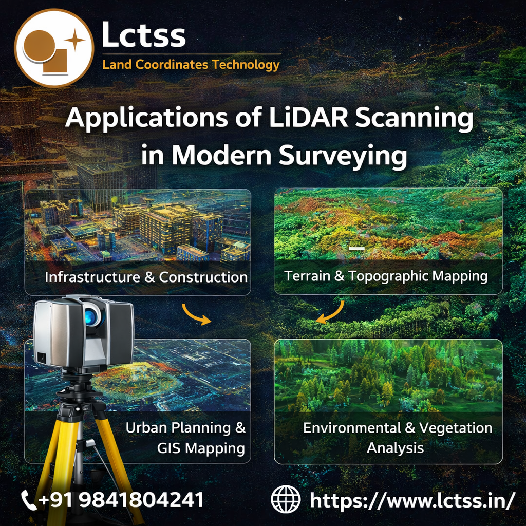
Mining companies also rely on LiDAR technology to survey mining sites and monitor excavation progress. The ability to capture accurate terrain data helps mining engineers manage operations efficiently while ensuring safety and regulatory compliance.
Lctss (Land Coordinates Technology) provides comprehensive LiDAR scanning services that support various industries, including construction, infrastructure development, environmental analysis, and land surveying. By delivering high-quality spatial data, the company enables clients to make informed decisions and improve project outcomes.
Another major advantage of LiDAR scanning services is the ability to transform raw data into highly detailed digital models. Once the LiDAR system collects millions of data points, advanced software is used to process the information and generate accurate digital representations of the surveyed area.
These processed datasets can be used to create digital elevation models, contour maps, orthophotos, and 3D models of buildings and landscapes. Engineers and architects can integrate these models into design software such as CAD and GIS systems, allowing them to visualize projects in a realistic and interactive manner.
3D modeling also improves communication among project stakeholders. Designers, engineers, contractors, and clients can easily understand the project layout and identify potential challenges before construction begins. This level of visualization reduces misunderstandings and helps teams collaborate more effectively.
At Lctss (Land Coordinates Technology), advanced data processing techniques are used to convert LiDAR point cloud data into meaningful outputs that support engineering and surveying applications. The company ensures that clients receive accurate maps, models, and reports that can be easily integrated into their project workflows.
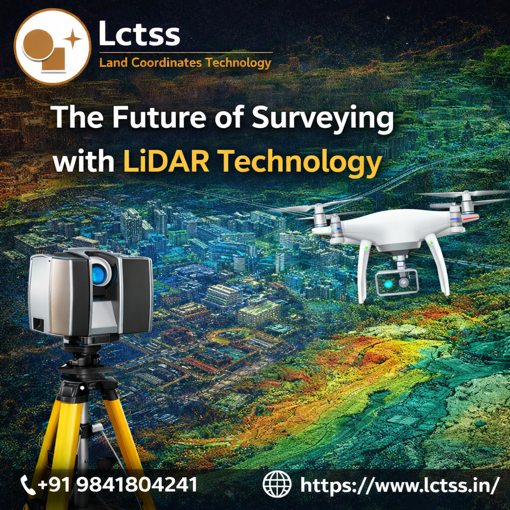
As infrastructure development continues to grow worldwide, the demand for accurate and efficient surveying solutions will continue to increase. LiDAR technology is expected to play a key role in the future of surveying, offering faster data collection, improved accuracy, and enhanced visualization capabilities.
The integration of LiDAR with emerging technologies such as drones, artificial intelligence, and geographic information systems is further expanding its capabilities. Drone-based LiDAR surveys are becoming increasingly popular because they allow surveyors to capture detailed data in remote or hazardous areas without putting personnel at risk.
Artificial intelligence and machine learning algorithms are also improving the efficiency of LiDAR data processing. These technologies can automatically classify objects within point cloud datasets, such as buildings, vegetation, roads, and terrain features.
This automated analysis speeds up the workflow and helps surveyors focus on interpreting the data rather than manually processing it.
Lctss (Land Coordinates Technology) continues to adopt the latest advancements in LiDAR technology to provide innovative surveying solutions for clients. By combining cutting-edge tools with professional expertise, the company ensures that every project benefits from accurate, reliable, and future-ready survey data.
LiDAR scanning services have become an essential component of modern surveying due to their ability to capture highly accurate spatial data quickly and efficiently. From infrastructure development and construction planning to environmental monitoring and urban development, LiDAR technology provides valuable insights that support better decision-making.
Compared to traditional surveying methods, LiDAR offers superior accuracy, faster data collection, and the ability to create detailed 3D models of complex environments. These advantages make it a preferred choice for engineers, planners, and survey professionals working on large and complex projects.
With its commitment to innovation and precision, Lctss (Land Coordinates Technology) provides reliable LiDAR scanning services that help clients achieve accurate and efficient survey results. By leveraging advanced equipment, expert professionals, and modern data processing techniques, Lctss (Land Coordinates Technology) continues to support the evolving needs of modern surveying and infrastructure development.