


Table of Contents
ToggleIn today’s fast-paced infrastructure and geospatial industry, accurate spatial data is essential for planning, engineering, construction, and asset management. Advanced LiDAR Point Cloud Data Processing & Production has become one of the most reliable technologies for capturing highly detailed three-dimensional information about the Earth’s surface. Land Coordinates Technology (LCTSS) specializes in delivering high-quality LiDAR data processing solutions that help government agencies, engineering consultants, infrastructure developers, utility companies, and environmental organizations make informed decisions based on precise geospatial information.
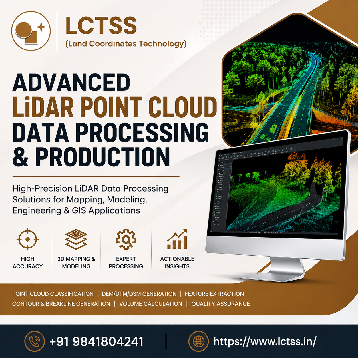
LiDAR (Light Detection and Ranging) technology captures millions of laser points within seconds, producing dense point cloud datasets that accurately represent terrain, vegetation, buildings, roads, power lines, and other physical features.However, raw LiDAR data requires advanced processing techniques before it becomes useful for engineering or GIS applications. LCTSS combines experienced geospatial professionals, advanced software platforms, and proven quality control procedures to transform raw LiDAR point clouds into highly accurate deliverables suitable for a wide range of industries.
At LCTSS (Land Coordinates Technology), we provide end-to-end Advanced LiDAR Point Cloud Data Processing & Production services tailored to project-specific requirements. Our workflow begins with importing raw LiDAR datasets collected through airborne, UAV, mobile mapping, or terrestrial laser scanning systems. Every dataset undergoes rigorous quality assessment to identify noise, overlaps, calibration issues, and inconsistencies before detailed processing begins.
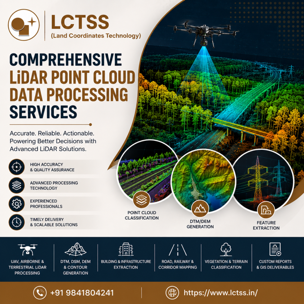
Our experts perform point cloud classification using industry-standard methodologies to categorize data into ground, vegetation, buildings, bridges, water bodies, transmission lines, road surfaces, railways, and other relevant classes.
Proper classification ensures that engineering consultants, surveyors, GIS professionals, and planners receive organized datasets that can be directly integrated into design and analysis workflows.
LCTSS also specializes in noise removal, outlier filtering, strip adjustment, point cloud alignment, coordinate transformation, intensity correction, and data optimization to improve the overall quality of the processed LiDAR data. These procedures ensure that every deliverable meets international quality standards while maintaining maximum positional accuracy.
Using advanced algorithms and professional geospatial software, we generate highly accurate Digital Elevation Models (DEM), Digital Terrain Models (DTM), Digital Surface Models (DSM), contour maps, breaklines, slope maps, hillshade models, and terrain analysis outputs. These datasets support numerous applications including highway planning, railway engineering, urban development, mining operations, flood modeling, forestry management, environmental monitoring, and utility corridor mapping.
The value of LiDAR technology lies not only in data collection but also in producing meaningful outputs that simplify decision-making. LCTSS delivers customized LiDAR Point Cloud Data Processing solutions that meet the needs of engineers, architects, GIS analysts, survey professionals, construction firms, and government departments.
Our production services include feature extraction for roads, buildings, bridges, power transmission lines, utility corridors, drainage systems, rivers, lakes, vegetation, pipelines, railway infrastructure, and transportation networks. These extracted features are carefully verified through multiple quality assurance procedures to ensure positional accuracy and consistency.
For infrastructure development projects, our processed LiDAR datasets enable engineers to perform accurate route planning, volume calculations, earthwork estimation, slope analysis, and terrain modeling. Urban planners benefit from detailed 3D city models that support smart city initiatives, zoning studies, disaster preparedness, and municipal planning.
LCTSS also produces high-resolution orthophotos integrated with LiDAR datasets, enabling clients to visualize geographic features with exceptional clarity. These combined datasets improve planning accuracy for road widening projects, industrial developments, renewable energy projects, airports, ports, and public infrastructure initiatives.
Our team is experienced in handling large-scale datasets covering thousands of square kilometers while maintaining efficient turnaround times. Whether the project involves UAV LiDAR surveys, airborne LiDAR mapping, terrestrial laser scanning, or mobile mapping systems, we ensure consistent, accurate, and reliable production workflows.
The applications of Advanced LiDAR Point Cloud Data Processing & Production continue to expand as organizations increasingly rely on digital geospatial information. LCTSS supports projects across numerous sectors by delivering customized datasets that improve planning, monitoring, and operational efficiency.
In transportation infrastructure, processed LiDAR data assists in highway design, railway corridor planning, bridge inspections, road inventory management, and traffic infrastructure development. Engineering consultants utilize accurate terrain models for alignment studies, cross-section generation, and construction planning.
Utility companies depend on LiDAR point cloud processing for transmission line mapping, power corridor analysis, vegetation encroachment assessment, pipeline route planning, and asset inventory management. Accurate three-dimensional models significantly reduce inspection time while improving maintenance planning.
Mining companies benefit from LiDAR-derived terrain models for stockpile volume estimation, excavation monitoring, mine planning, and environmental compliance. Forestry organizations use classified point clouds for canopy height analysis, biomass estimation, forest inventory, and vegetation health monitoring.
Government departments and municipal authorities leverage LiDAR products for land administration, flood risk assessment, watershed management, disaster mitigation planning, smart city implementation, urban development, and environmental conservation. Survey firms integrate processed LiDAR datasets into GIS platforms to support cadastral mapping, infrastructure planning, and land development projects.
Construction companies also rely on LiDAR data production for site planning, progress monitoring, digital twins, clash detection, and construction verification. The ability to capture and process millions of measurements enables project teams to reduce field visits while improving overall project accuracy.
Land Coordinates Technology (LCTSS) has established itself as a trusted provider of advanced geospatial solutions by combining technical expertise, modern software platforms, and stringent quality assurance processes. Our experienced team understands the complexity of LiDAR datasets and delivers outputs that align with international surveying and GIS standards.
We focus on accuracy, consistency, and timely project delivery while maintaining complete data integrity throughout the processing workflow. Every project undergoes multiple stages of validation and quality checks before final delivery, ensuring that clients receive dependable datasets suitable for engineering design, GIS analysis, mapping, and decision-making.
Our comprehensive production capabilities include point cloud classification, feature extraction, DEM, DTM, DSM generation, contour creation, breakline extraction, 3D modeling, orthophoto integration, volumetric analysis, terrain modeling, and customized GIS deliverables. We work closely with clients to understand project objectives and provide solutions that maximize the value of LiDAR technology.
With extensive experience supporting infrastructure development, utility mapping, transportation projects, environmental studies, mining operations, forestry management, and urban planning, LCTSS continues to deliver reliable Advanced LiDAR Point Cloud Data Processing & Production services for clients across India and international markets.
As demand for high-quality geospatial information continues to grow, organizations require accurate, scalable, and efficient data production services that support informed decision-making. LCTSS remains committed to providing innovative LiDAR processing solutions that enable engineers, planners, surveyors, GIS professionals, and government agencies to execute projects with confidence. Our dedication to quality, precision, and customer satisfaction makes Land Coordinates Technology the preferred partner for advanced LiDAR point cloud data processing and production services.