


Table of Contents
ToggleIn today’s data-driven world, Geographic Information Systems (GIS) have become an essential technology for mapping, planning, infrastructure development, environmental monitoring, and land management. Organizations across government, construction, urban planning, transportation, agriculture, and utility sectors rely heavily on GIS professionals to analyze spatial data and make informed decisions. To meet this growing industry demand, LCTSS (Land Coordinates Technology) offers a comprehensive GIS Professional Course with QGIS, ArcGIS and Spatial Data Analysis designed to equip students, engineers, surveyors, and working professionals with practical geospatial skills that are highly valued in the job market.
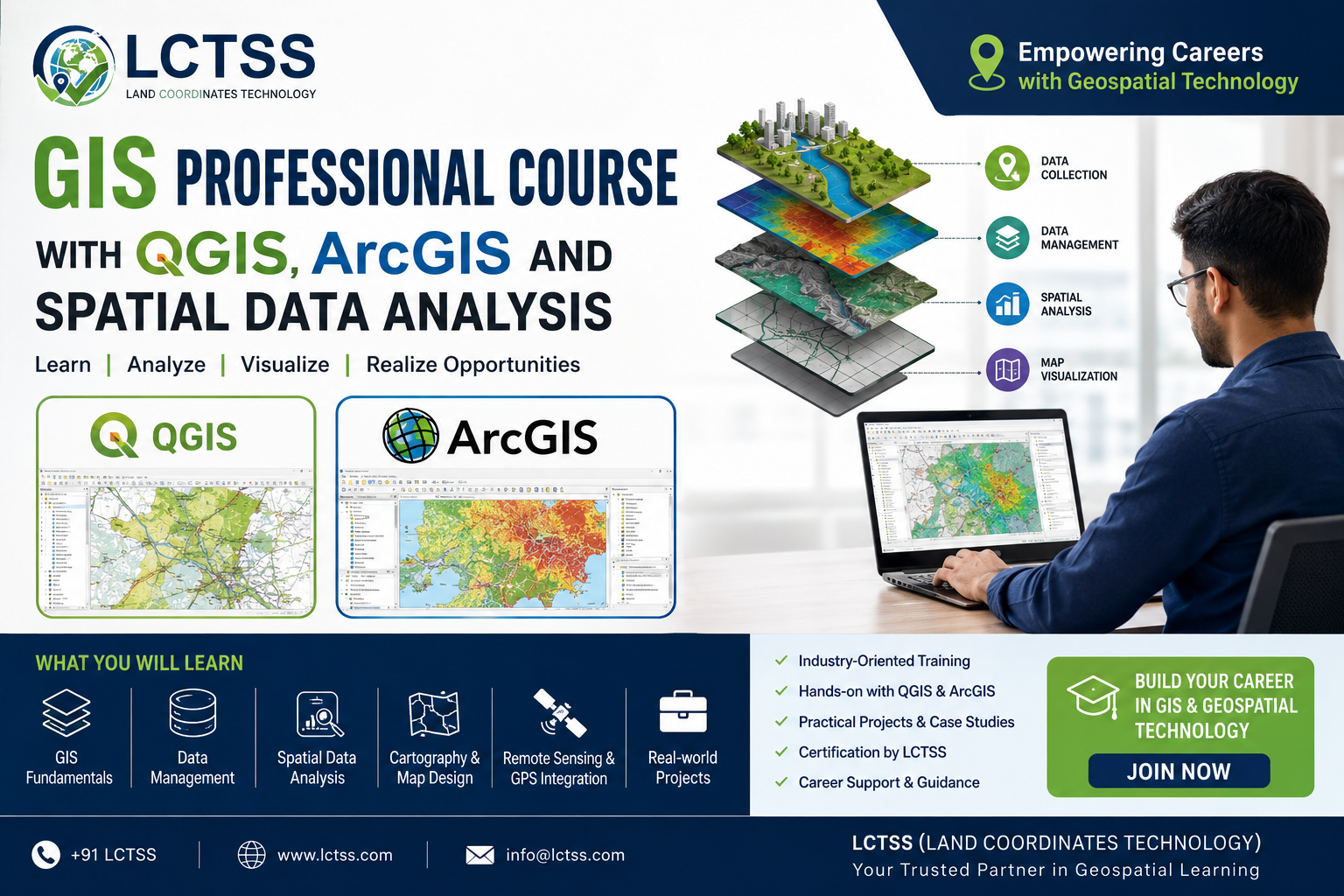
The GIS Professional Course at LCTSS provides a strong foundation in geographic information systems while emphasizing hands-on training with industry-leading software such as QGIS and ArcGIS. Participants learn how to collect, manage, analyze, visualize, and interpret geographic data for real-world applications. The course combines theoretical concepts with practical exercises, enabling learners to develop confidence in handling spatial datasets and producing professional-quality maps. Whether you are a beginner looking to start a career in GIS or an experienced professional seeking to upgrade your skills, this training program offers the knowledge and practical experience needed to succeed in the rapidly evolving geospatial industry.
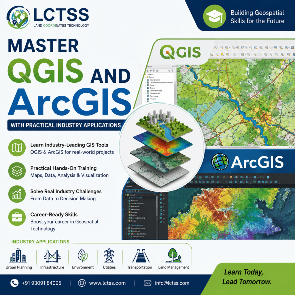
QGIS and ArcGIS are among the most widely used GIS platforms in the world. Understanding these tools is essential for anyone pursuing a career in geospatial technology. The GIS Professional Course at LCTSS provides detailed training on both software platforms, helping learners understand their capabilities and applications in various industries.
Students begin by learning the fundamentals of GIS, including coordinate systems, projections, spatial databases, vector data, raster data, and map design principles.As the training progresses, participants gain hands-on experience in creating maps, digitizing geographic features, managing geospatial databases, performing spatial queries, and generating analytical reports.
Through practical projects and case studies, learners understand how GIS technology supports decision-making processes in construction, land surveying, urban development, transportation planning, and environmental management.
The course also covers advanced mapping techniques using QGIS and ArcGIS, enabling participants to create thematic maps, land-use maps, utility maps, transportation networks, and environmental assessment maps. Learners gain practical exposure to data visualization methods that transform raw geographic information into meaningful insights. This hands-on approach ensures that students develop job-ready skills that can be immediately applied in professional environments.
One of the most valuable components of the GIS Professional Course is the comprehensive training in Spatial Data Analysis. Modern organizations require more than simple maps; they need actionable insights derived from geographic data. Spatial analysis techniques help professionals identify patterns, trends, relationships, and opportunities hidden within large datasets.
At LCTSS, participants learn various spatial analysis methods including buffer analysis, overlay analysis, network analysis, terrain analysis, suitability analysis, hotspot identification, and proximity analysis. These techniques are widely used in infrastructure planning, site selection, disaster management, environmental monitoring, and resource management projects. By mastering spatial analysis tools, learners develop the ability to solve complex real-world challenges using geographic information.
The course also introduces geospatial intelligence concepts that help organizations improve planning accuracy and operational efficiency. Students learn how to integrate multiple datasets, perform advanced data processing, and generate meaningful reports that support strategic decision-making. Practical assignments and project-based learning allow participants to apply analytical techniques to real-world scenarios, enhancing both technical expertise and problem-solving capabilities.
In addition to spatial analysis, learners gain exposure to remote sensing data integration, GPS data processing, and geospatial data management. These skills significantly increase employability and open opportunities in various industries including surveying, GIS consulting, infrastructure development, environmental services, and government agencies.
The demand for GIS professionals continues to grow as organizations increasingly adopt digital mapping and geospatial technologies. Completing the GIS Professional Course with QGIS, ArcGIS and Spatial Data Analysis at LCTSS can open doors to a wide range of career opportunities. Graduates can pursue roles such as GIS Analyst, GIS Technician, Geospatial Specialist, Mapping Engineer, Remote Sensing Analyst, Spatial Data Analyst, Urban Planning Consultant, Survey GIS Coordinator, and Infrastructure GIS Engineer.
Employers seek professionals who possess practical experience with GIS software and strong analytical skills. The industry-oriented training approach followed by LCTSS ensures that participants gain exposure to real-world workflows used by geospatial companies and engineering organizations. Through project-based learning, students develop portfolios that demonstrate their technical capabilities and increase their competitiveness in the job market.
GIS technology is now a critical component of smart city initiatives, transportation planning, utility management, environmental conservation, telecommunications, mining, agriculture, and construction projects. Professionals with GIS expertise are often involved in planning and managing large-scale infrastructure developments where accurate spatial information plays a vital role. As digital transformation continues across industries, GIS skills remain highly valuable and offer strong long-term career prospects.
LCTSS focuses on delivering practical, industry-relevant education that aligns with current market requirements. Experienced trainers guide participants through every stage of the learning process, ensuring they gain both conceptual understanding and hands-on expertise. The course structure is designed to help learners confidently apply GIS concepts in professional environments and contribute effectively to geospatial projects.
For students, civil engineers, surveyors, planners, architects, environmental professionals, and working executives seeking career advancement, the GIS Professional Course with QGIS, ArcGIS and Spatial Data Analysis offered by LCTSS provides an excellent opportunity to develop specialized geospatial skills. With comprehensive software training, advanced spatial analysis techniques, real-world project exposure, and industry-focused learning, this course prepares participants for successful careers in the expanding field of Geographic Information Systems. By acquiring expertise in QGIS, ArcGIS, and spatial data analysis, learners can position themselves at the forefront of modern mapping and geospatial technology, creating new opportunities for professional growth and long-term success.